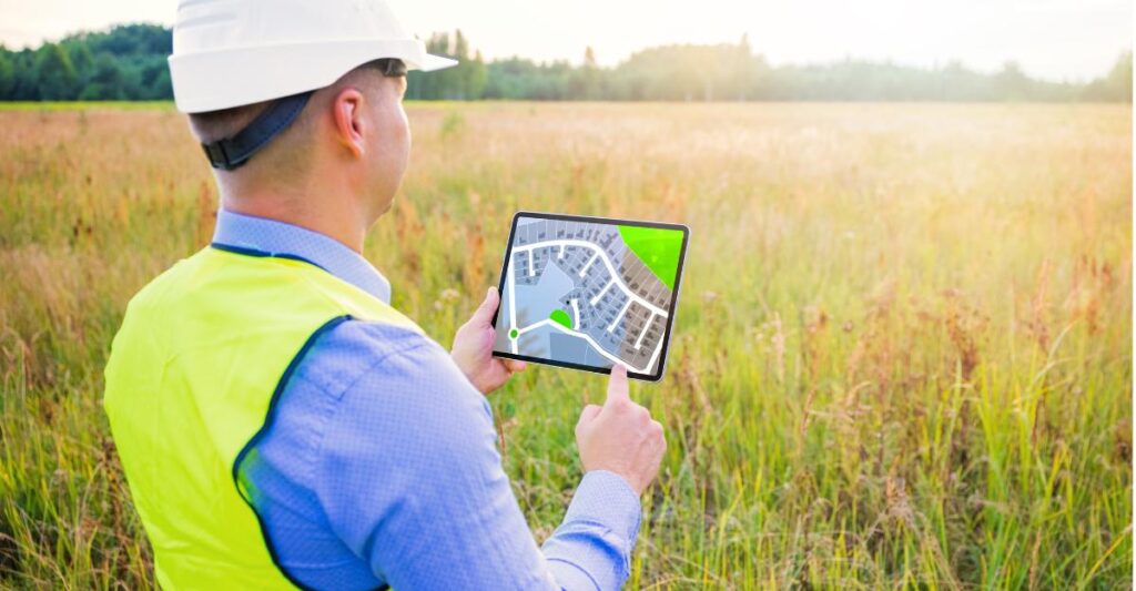
Measuring land quickly, accurately and without complications is a growing need, especially for professionals such as engineers, architects and agronomists, as well as enthusiasts who need to understand the boundaries and dimensions of their properties. Technological advances have allowed digital tools, accessible directly from a smartphone, to replace complex traditional equipment.
These apps offer modern features such as the use of GPS, high-resolution cameras, and digital maps to take accurate measurements. With intuitive interfaces, they have democratized the process, allowing both laymen and experts to use them efficiently. Below, we explore five standout apps in this segment.
1. GLand Measure Area Meter
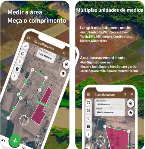
Image: Apple App Store
Available for devices iOS and Android, the GLand Measure Area Meter is a practical tool for calculating areas and distances using GPS maps. It allows the user to draw areas directly on the map or use the trajectory function for more dynamic measurements.
With features such as data export in formats compatible with CAD systems and integration with satellite images, GLand Measure stands out for its accuracy. It is ideal for measurements on uneven terrain, in addition to offering a simple interface that facilitates the learning curve.
2. Field Area Measurement
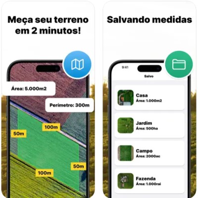
Image: Apple App Store
The Field Area Measurement app is a favorite for rural professionals. Available on Apple App Store and Google Play Store, it combines practical measurement functionalities with specific features such as calculating arable areas.
With a user-friendly interface, the app allows users to create area outlines directly on the map or use GPS coordinates for greater precision. In addition, there are export options in formats such as KML and GPX, making it an essential tool for planning activities on rural properties.
3. AutoCAD

Image: Apple App Store
AutoCAD, known by engineering and architecture professionals, is also available in a mobile version on Apple App Store and Google Play Store. Although it is more robust and complete, its version for portable devices includes features that allow precise terrain measurements.
With features like detailed editing and compatibility with DWG files, AutoCAD is excellent for complex projects. Although it is more sophisticated, using it on mobile devices requires a steeper learning curve, but it makes up for it by offering detailed control and integration with professional projects.
4. Magicplan
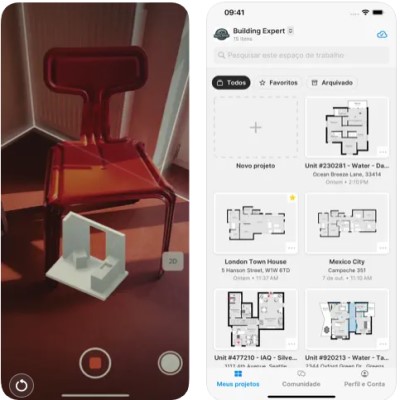
Image: Apple App Store
Magicplan is a popular app for indoor and outdoor measurements, available both on Apple App Store as in Google Play Store. It uses the device's cameras and sensors to capture dimensions and generate detailed floor plans.
This application is widely used by professionals who want to quickly create floor plans or site plans. Its export tools include formats such as PDF, JPG, and DXF, making it a versatile resource for measurements and documentation.
5. Planimeter
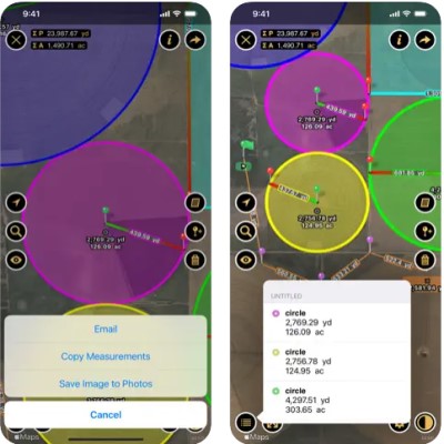
Image: Apple App Store
With an intuitive approach, Planimeter stands out for its measurement accuracy and ease of use. Available for iOS and Android, it offers features such as area and distance calculation on interactive maps.
The app lets you measure any type of terrain, even in places with limited connectivity, thanks to the option to save maps offline. Its straightforward interface makes it easy to use for both beginners and professionals, making it a popular choice among those looking for simplicity and efficiency.
How to use apps to measure land
Using land surveying apps can transform the way you survey and organize information about your property. The process starts with choosing a reliable app that is suited to the type of measurement you need. Make sure the device has built-in GPS and that the sensors are properly calibrated.
When starting the measurement, look for a location with good visibility of the satellites, avoiding densely wooded areas or urban areas with tall buildings that could block the signal. Also, pay attention to the weather conditions, as heavy rain, fog or thick clouds can compromise the accuracy of the GPS sensors, leading to errors in the calculations.
When measuring, it is essential to monitor in real time how the terrain contours are being drawn on the digital map. Many applications offer features that allow you to correct inconsistencies immediately, avoiding the need to redo the work later. Be careful when adjusting points or markers, ensuring that they correspond to the actual edges of the terrain.
Once you’ve finished collecting your data, review it thoroughly before saving or exporting it. Make sure the export format is compatible with other software you or your team might use, such as CAD tools or spreadsheets. This integration is crucial for the data to have broader practical applications, such as construction projects or agricultural planning.
How to choose the best land measurement app?
Choosing the best land surveying app requires a thorough analysis of your specific needs. The first step is to determine the type of activity you want to perform. For example, construction and architecture professionals may prioritize robust applications that allow for accurate and detailed measurements, such as AutoCAD or similar programs that offer integrations with technical projects.
For those working in the rural or agricultural sector, applications such as GLand Measure and Field Area Measurement are the best options. These applications were specifically designed to calculate large areas and deal with aspects such as irregularities in the terrain. The simplicity and functionality of these tools ensure greater efficiency in field measurements, even in regions far from urban centers.
Another essential aspect is the user's level of experience with technology. If you are a beginner or unfamiliar with advanced tools, opt for intuitive apps, such as Planimeter and Magicplan. These apps have simple interfaces and user guides that make learning easier, ensuring fast and reliable measurements even for beginners.
Consider the cost involved as well. Many apps offer a free version with limited functionality and premium options that require a subscription. Consider which additional features are necessary for your work and make sure the investment is worth it. Also, check the app’s compatibility with your device by making sure it’s available for download in the corresponding digital store.
What types of areas can I measure with these apps?
Land measurement apps allow for a wide range of applications, meeting both professional and personal needs. They stand out for their versatility and ability to deliver accurate results in a variety of scenarios.
- Rural land: They are ideal for measuring crop areas, pastures and nature reserves. These applications help determine the exact size of properties, plan efficient land use and monitor expansions. With functions such as delimiting perimeters and calculating irregular areas, they are indispensable for agronomists, farmers and environmental managers.
- Urban properties: These applications allow for detailed measurements of residential, commercial, and industrial lots. They help verify square footage for real estate negotiations, construction projects, or even legal compliance. Accuracy is key in urban environments, where every square foot can impact property value.
- Constructions: They are useful for measuring internal and external areas of buildings, assisting in the distribution of spaces and architectural planning. With these applications, it is possible to calculate useful areas, check spaces for installations and create accurate plans. This functionality serves both engineering professionals and interior decorators and designers.
- Infrastructure: Infrastructure projects such as roads, bridges and other civil engineering projects can also be easily measured. These applications offer specific features for large-scale projects, such as calculations of linear distances, slopes and areas of intervention. This facilitates the planning, execution and monitoring of projects, ensuring greater efficiency.
Measurement accuracy varies depending on the application and usage conditions. Many offer a small margin of error, but it is essential to follow good measurement practices, such as avoiding interference with the GPS signal and reviewing the collected data to ensure reliable results.
FAQs for land measurement apps
Most applications offer measurements with a minimum margin of error, as long as they are used in good GPS signal conditions and with proper calibration procedures.
Yes, these applications are designed to calculate irregularly shaped areas, making them extremely useful for terrains with non-linear contours.
Yes, many apps support offline maps, such as Planimeter, allowing you to take measurements in remote locations without an internet signal.
Yes, many applications allow you to export data in formats such as PDF, JPG, KML, GPX and DWG, making it easier to integrate with other tools or software.
What did you think of these land measurement apps?
Land measurement apps have revolutionized the way we manage and analyze spaces. They offer a modern solution to an old problem, combining technology and practicality in a format accessible to everyone.
Whether you are a professional or a regular user, the tools discussed in this article will certainly meet your needs. The right choice depends on the type of project and the type of technology that gives you the most security and comfort when using it.